Contact: Val Murray
See Newsletter for contact details or
Email: with “Mapping Bramhall enquiry” as the subject
Mapping Bramhall
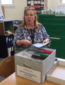
Our archive of projects made over 13 years has been assembled, catalogued and donated to Stockport Heritage Library. A digital version is available HERE.
A few years ago, we had an interesting and informative visit from a member of Sustainable Bramhall and as usual went on a local walk together.
Other interesting group projects included marl pits in Bramhall and their legacy as ponds, building styles in different roads, a survey of front gardens and a survey of local cafes.
Our broad themes are history, the built environment, nature, organisations, observations and maps. Topics we have investigated include the evolution and uses of buildings and areas of land, industry and business, local people, care homes, recreational facilities, churches, schools, rivers, footpaths, bridges, moss and favourite maps. Variety is added with cafe surveys, local walks, sitting and observing, tradespeople recommendations and the occasional quiz.
We have accumulated an archive, both physical and digital, of over 260 items and it is lodged with Stockport Local History Archive.
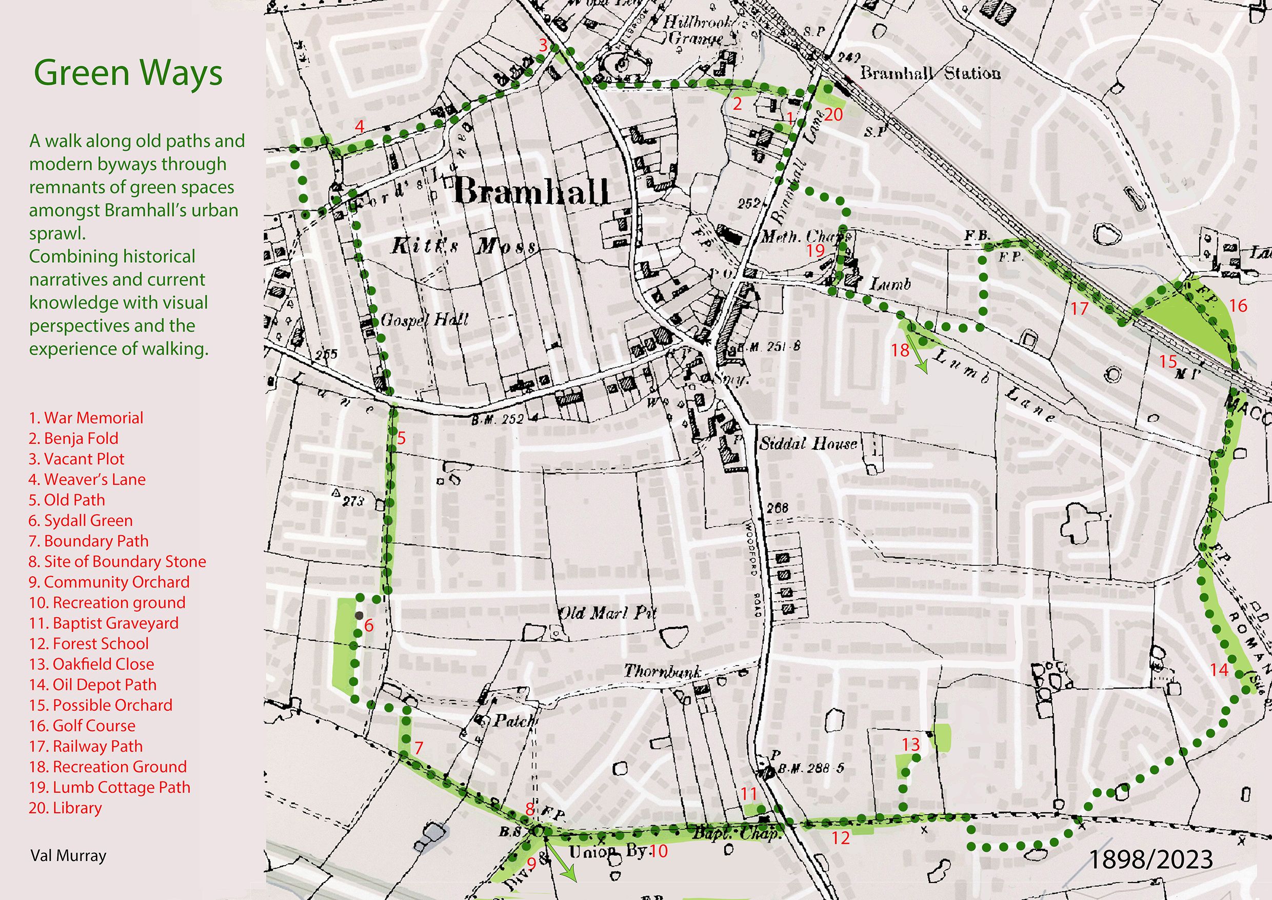
The Bramhall Greenways Walk Greenways is a 3½ mile circular walk along old paths and modern byways. It runs through remnants of green spaces in Bramhall and combines historical narratives with current knowledge. Paper copies of the walk leaflet are available at Bramhall Library. | |
 |  |
Manchester Place Names
There is also a free online dictionary of Place Names in Manchester compiled by one of our group. See the link : Manchester Place Names
Tea, biscuits and sharing local news are an important part of our meetings which take place round the co-ordinator’s kitchen table.
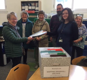
Val Murray (extreme left) of the u3a Mapping Bramhall Group presenting their archive to Michelle Hewitt, Senior Librarian at the Stockport Heritage Library. 26th April 2023.
 |  |
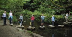
Members of the Bramhall Mapping Group surveying the Ladybrook Valley